A day in the life of RV Keary
David Hardy,GSI
The RV Keary is a 15m aluminium catamaran, built for and operated by the Geological Survey of Ireland (GSI) [www.gsi.ie]. Its primary function is to provide an inshore survey capability for the national INFOMAR programme (INtegrated Mapping FOr the Sustainable Development of Ireland’s MArine Resource) [www.infomar.ie].
As a small inshore survey vessel, she normally operates with a crew of three: two serving as scientists/deckhands, while the third is the vessel’s skipper. For extended operations, a fourth crew member serves as a relief watch officer.
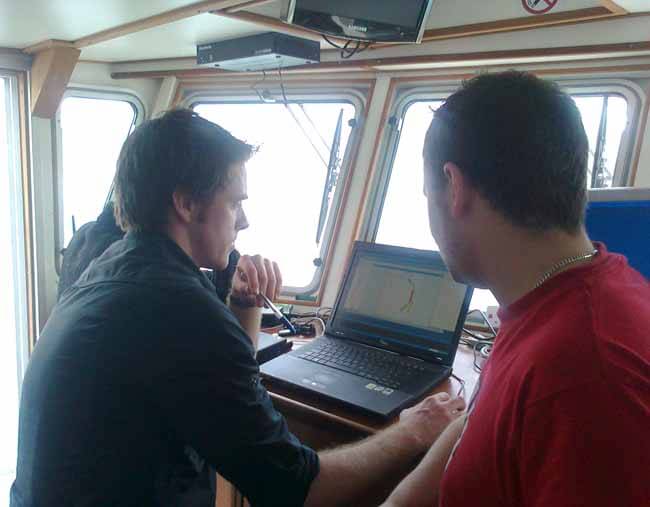
Ronan O’Toole and Niall Finn quality check data in real-time
The boat has two cabins with two bunks in each; a toilet/shower area and a small compact galley. Most of the internal space is dedicated to the precision depth finding equipment, high resolution GPS system, ancillary sensors and related IT infrastructure.
Initialisation
During normal working days, the scientific instruments are started up 30 minutes before surveying to allow time for them to initialise and reach operational state. During this time, the crew grab a brief breakfast, collect any food supplies needed and check over the engines and safety equipment.
Once all systems are operational, the vessel moves to the area to be surveyed. Before survey operations can commence, visual checks are performed for marine mammals (dolphins, whales etc) and a ‘soft-start’ is instigated on the depth-finding equipment (the instruments are started at a low power and are gradually increased to operational levels to ensure that no marine mammals are startled or distressed by the acoustic systems in keeping with international and national guidelines.
Survey operations are performed by running a series of parallel track lines. While underway, the vessels scientific equipment collects a ‘fan’ of depth readings, oriented across the vessels width. The area covered is a function of water depth – normally the ‘fan’ covers approximately six times the water depth. Each set of readings provides the water depth at 508 points – with 15 sets of readings being observed every second.
3D representation
All of these depth measurements are combined to generate a 3D representation of the seafloor. Gradually the survey area is ‘painted in’ to achieve 100% coverage of the seafloor, with adequate overlap allowing identification of shoals, wrecks or other features in an area.
In addition to collecting depth readings, the systems identify composition and relative hardness of the seafloor. This additional information assists in geological mapping, habitat assessments and fisheries research.
During survey operations, one crewmember is responsible for safe pilotage of the vessel and serves as the skipper. A second crewmember operates the ‘real-time’ collection of data, and assesses the quality and extent and makes any necessary adjustments. This person also assists the skipper primarily by keeping a look-out for fishing gear. If marine mammals are spotted they are recorded and forwarded to the relevant authorities.
The third crewmember processes the data. The depth readings acquired must be corrected for a range of factors; the vessel’s motion and positioning; local variations in water temperature and salinity; the influence of tides; erroneous readings etc before a 3D surface or chart can be created . This processing is quite lengthy but is started onboard so that any errors can be identified and corrected. As this work does not need to be done in real-time, this person is free to prepare meals and generally maintain the vessel.
Seabed samples
On suitable days a break from ‘painting in’ a survey area can be spent taking physical samples of the seabed with equipment deployed from the vessels A-frame. Side Scan Sonar equipment can also be utilised to image wrecks or shoals to determine if there are any masts that can be missed by the echo-sounder equipment. Occasionally a small ROV is used to inspect the seabed or objects detected by the sonar.
Under ideal conditions, survey operations would cover 10 hours per day and a further two hours for preparation, system start-up/shutdown and vessel maintenance. When working in shallow, near-shore waters, however, weather and tidal conditions might call for a shorter day. At the end of each survey day, the data is backed up to the onboard computer system as the vessel returns ashore.