
RMS Lusitania: The Story of a Wreck
The dramatic circumstances surrounding the loss of RMS Lusitania, one of the world’s largest and fastest ocean-going liners of the time, has fascinated maritime historians, underwater archaeologists and the public at large since the ship was torpedoed by a German U-boat 18km off Ireland’s south coast in 1915.
The sinking of RMS Lusitania in 18 minutes, killing 1,197 passengers and crew, was a contributing factor in the United States joining the allied forces and declaring war on Germany two years later.
The wreck has been the subject of much investigation, research and survey work and was afforded protection by Underwater Heritage Order in 1995.
Collaboration between the National Monuments Service (DCHG) and INFOMAR (Geological Survey Ireland and the Marine Institute) has enabled ongoing research, leading to the production of a new book that tells not only the story of ship but of other World War I losses off the Irish coast.
Newspaper images, postcards, paintings, photographic collections and a range of other sources illustrate the global impact of the sinking of RMS Lusitania.
Ministerial launch
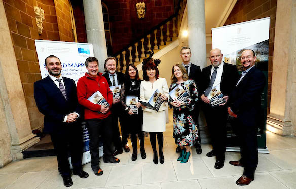
Josepha Madigan, Minister for Culture, Heritage and the Gaeltacht said the publication had been “meticulously researched” and would be “an essential work of reference” for anyone interested in heritage studies and maritime affairs:
“As we continue through our decade of centenaries, there are few greater tragedies to remember than the sinking of the Lusitania. Most of the 90 Irish men, women and children listed as passengers were lost when the liner went down.”
Also onboard were unlisted Irish working on the ship and men who had emigrated to Liverpool and had found work as firemen, trimmers, stokers and greasers in the Lusitania’s boiler rooms.
“Their loss tells us of the enduring story of Ireland, of the pendulum of emigration and immigration, of people seeking better lives on one-way journeys to new lives in America or those able to visit back home, or coming home for good.”
Current status
Recent acquisition of detailed high-resolution scans carried out by INFOMAR (INtegrated Mapping FOr the Sustainable Development of Ireland’s Marine Resource) provides new imagery of how the shipwreck looks on the seafloor today.
As well as drawing on expertise from the National Monuments Service’s Underwater Archaeology Unit, GSI, the Marine Institute and the National Museum of Ireland, independent researchers, divers and specialists also contributed to the publication.
Seán Canney, Minister of State, Department of Communications, Climate Action & Environment, said that for the past twenty years, Ireland’s offshore waters and coastal areas have been subject to one of the largest seabed surveys in the world:
“INFOMAR is Ireland’s national marine mapping programme, the follow-on project to the Irish National Seabed Survey (INSS) which began in 1999. Through INFOMAR, state-of-the-art sonar imagery of the wreck of the Lusitania has been acquired, creating a valuable dataset for the monitoring of this historically significant wreck site.
“This collection of data along with the story of this great liner, provides us with a platform to raise further awareness of the importance of our maritime history and to allow further research and analysis to be undertaken.”
RMS Lusitania – The Story of a Wreck is co-authored by Fionnbarr Moore, Connie Kelleher and Karl Brady (NMS), Charise McKeon (GSI) and Ian Lawler (BIM), supported by contributions.
It is available from the Stationery Office and major booksellers priced €20.
(Review: Inshore Ireland (Winter 2019) publishing January 11)
