
Ireland’s marine resource potential is recognised by government
& Gery Flynn
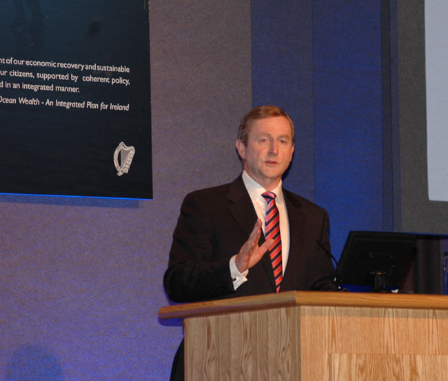
Government commitment to develop Ireland’s marine resource was underpinned yesterday by the presence of An Taoiseach Enda Kenny and four cabinet colleagues at the first annual conference of Our Ocean Wealth - the integrated marine plan for Ireland.
“Today’s conference is a way of showing that the government is serious about the potential of this sector, and that we’ve decided to take real, strong, clear action,” remarked An Taoiseach Enda Kenny
An Taoiseach Enda Kenny speaking at Our Ocean Wealth conference in Dublin Castle. Photo Gillian Mills
“And we’re saying to people who are thinking about investment to look at this plan, and look at our progress. You can see where our commitment is. Add to that your ideas, your own initiatives, your own propositions because now is the time to get really serious about this.

The ‘real’ map of Inisbofin
Eoin Mac Craith, GSI
In July 2012, the Geological Survey of Ireland vessels RV Keary and RV Geo arrived at Inishbofin, off the coast of Co Galway, with the goal of mapping the underwater terrain surrounding the island. This work took place as part of the INFOMAR seabed mapping programme ― a national project that ultimately aims to map all of Ireland’s inshore waters and offer the data freely available to the public.
RV Keary is a 15m aluminium catamaran purpose-built for inshore mapping, while RV Geo is a 7.5m RIB (Rigid Inflatable Boat) used to enter very shallow water adjacent to intertidal areas and to put the finishing edges to INFOMAR’s marine maps.
National marine conference 2014
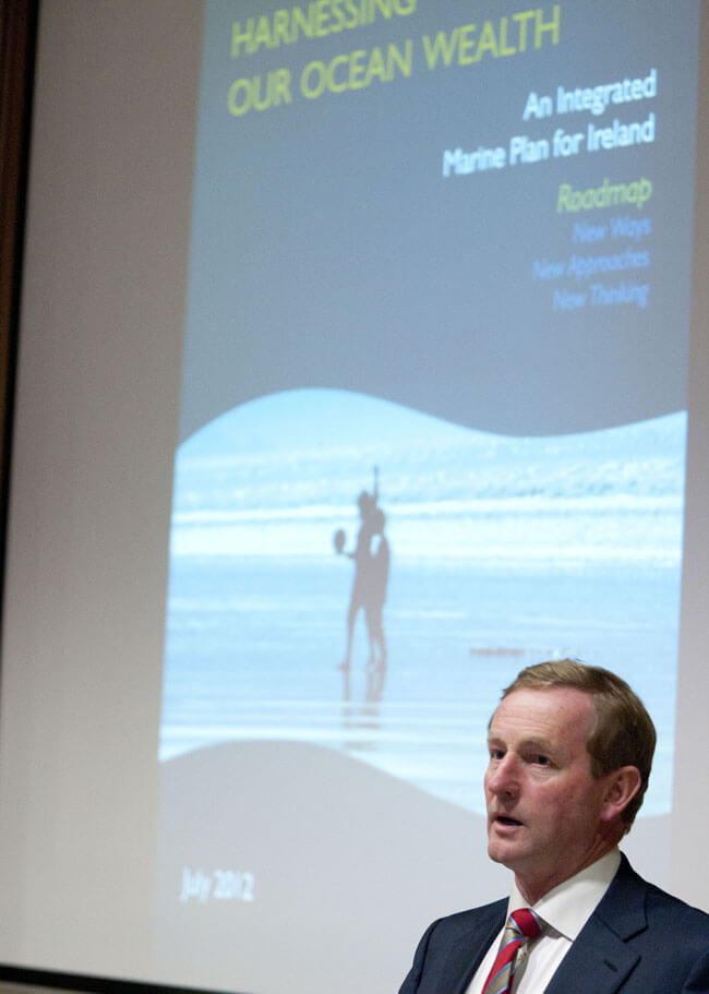
The first annual review on progress implmentation of the Government's 2012 publication: Harnessing our Ocean Wealth: An Integrated Marine Plan for Ireland, takes place in Dublin Castle on June 18 next.
An Taoiseach Enda Kenny launches Harnessing our Ocean Wealth, July 2012. Photo David Ruffles
The conference will cover four themes and include key speakers and panel discussions:
- global opportunity for Irish seafood
- research & innovation and emerging sectors
- energy - offershore hydrocarbons
- where land meets the sea - opportunities and challenges for marine tourism

Highest level recognition of marine resource potential
When it was launched in July 2012 the Harnessing Our Ocean Wealth strategy was broadly welcomed throughout the maritime community as being a significant achievement by government and a welcome first step on the road to tapping into a global marine market for seafood; tourism; oil and gas; renewable ocean energy, and more, worth €1.2bn.
At the time, and by way of a compliment to the professionalism of those concerned, we described the strategy launch as a ‘master class of meticulous and highly choreographed planning’. Two years later the same praise is justly fitting, following the first HOOW conference.
Ten years on and ICZM is still somewhere on the distant horizon
A look back ten years to Inshore Ireland’s first lead story sees us bemoaning the lack of an effective, workable national policy for Integrated Coastal Zone Management. Looking deeper into that article, a key finding of a 2004 review of ICZM by the Heritage Council leaps out ― the stark reality that up to 2005 there had been no advances in policy or legislative developments for ICZM since the publication of a draft policy for Ireland in - 1997!
And staying with that first article we also reported that when compared to national case studies of how the policy of coastal management is handled in the UK, Norway, New Zealand and Australia, the Irish way of doing things is characterised by a sectoral approach to resource exploitation.

‘Surf beat’ recorded in Dingle Harbour
John Rapaglia, Luca Zaggia, Kevin Flannery
The first week of 2014 was marked by two large storms whose impacts were felt along the full length of the Atlantic Coast of Ireland. The extreme pressure gradients from these storms led to strong winds and subsequently great (> 30 m waves) offshore of Ireland’s west coast.
Although somewhat tempered by the time they reached Dingle Bay, wave heights during the late night of Jan 3 and early morning of January 6 reached 15 m. The department of Biology at Sacred Heart University, CT USA, in collaboration with Dingle Oceanworld Aquarium deployed two CERA Diver pressure sensors in Dingle Harbor during these storms.
One pressure sensor was located at the mouth of Milltown Creek and was set to read the water elevation at a frequency of 0.07 Hz in order to capture the tidal oscillation throughout the entire study period (January 1-January 8, 2014). The second pressure sensor was deployed 100 m N of the Dingle Harbor Lighthouse and set to record water elevation at a frequency of 2 Hz in order to capture waver height during the storm.

INIS Hydro delivers on key objective of future collaboration in seabed mapping
A closing seminar marking the end of INIS Hydro showcased the mapping achievements and capacity building of the data gathered over the 3-year project.
In the splendid Titanic Quarters in Belfast, delegates from many marine disciplines gathered for the event that also discussed further uses of the high resolution bathymetric survey data of 1,400 km2 of seabed in the Republic of Ireland, (Dundalk Bay), Northern Ireland (SE Mourne Coast, Carlingford Lough, Dundrum Bay) and Scotland (Firth of Lorn and Kintyre).
The INIS Hydro team on 'Titanic's' staircase
Opening his key note speech, Sir Alan Massey, KCB, CBE Chief Executive, Maritime and Coastguard Agency, admitted that at launch in July 2011, the project seemed like a “hugely ambitious” cross-border project:“
Surveying the white ribbon
Eoin McGrath, GSI
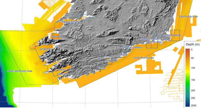
With the bulk of Ireland’s deep, offshore waters now mapped in great detail during the course of the Irish National Seabed Survey, the task of surveying the inshore territory has fallen to the INFOMAR programme (Integrated Mapping for the Sustainable Development of Ireland’s Marine Resource) – a joint venture run by the Geological Survey of Ireland and the Marine Institute.
White ribbon of seabed around the Irish coast yet to be surveyed by INFOMAR
Ireland’s rugged coastline makes for a challenging environment for the fleet of small vessels employed to carry out this duty: RV Keary, M.V. Cosantóir Bradán and RV Geo. These boats are required to venture where other vessels do not – areas of dangerous shoals and shallow rocks many of which have not been charted in over a hundred years. These areas to be mapped can be collectively termed as the ‘white ribbon’, ― the blank strip skirting Ireland’s coastline in the image of modern seabed data coverage.

Irish online service to aquaculture scoops European award
Lisa Fitzpatrick, Marine Instiute
ASIMUTH, an Irish-led EU Framework 7 funded project (FP7), has been awarded the COPERNICUS (Global Monitoring for Environment and Security) Masters Prize for best earth-monitoring service for European citizens 2013. The pan-European project developed an online alert system (HAB Forecast) to provide an early warning to the aquaculture industry of imminent harmful algal blooms (red tides).
ASIMUTH is led by the Daithi O’Murchu Marine Research Station, (DOMMRS) in Bantry and involves scientists and SMEs from five European Atlantic States (Ireland, Scotland, France, Spain and Portugal).
Glenn Nolan, Joe Silke and Claire Cusack, Marine Institute
Project partners include the Marine Institute and Irish SME Numerics Warehouse Ltd, Galway, as well as international MeteoGroup Offshore which has an office in Ennis, Co. Clare.