

News from the seabed…
Dr Anuschka Miller (SAMS) & André Cocuccio (MCA)
Since January 2011, a European Union funded project has been surveying areas including Dundrum Bay and SE Mourne Coast, Carlingford Lough and Approaches and Dundalk Bay, to gather information on the depth, shape and sediment type of the seabed. The project is also responsible for gathering data off the west coast of Scotland.
Multibeam echosounder image of newly discovered 113m long and 1.3m high shipwreck lying in Dundalk Bay at a minimum depth of 17.9m. Image courtest of Chris Martin, Marine Institute
With first results beginning to emerge, a previously unknown shipwreck has just been discovered in Dundalk Bay. So far, researchers have been unable to find any records relating to the wreck, which appears to lie upside down. Comprising a bulky rectangular object with a flat top surface and a long mast-like structure protruding from it, the wreck looks like a giant spade sitting on the seabed.

GeoSeas implements e-infrastructure of marine geological and geophysical data centres
Koen Verbrugggen, GSI
The GeoSeas Full Network meeting took place on April 18-19 in Santorini, organised by NOA – Oceanographic Agency of Greece.The Geo-Seas project is implementing an e-infrastructure of 26 marine geological and geophysical data centres located in 17 European maritime countries.
Users are enabled to identify, locate and access pan-European, harmonised and federated marine geological and geophysical datasets and derived data products held by the data centres through a single common data portal.
EMODnet project
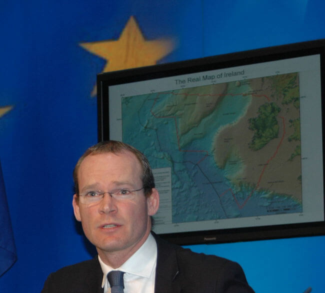
Dawn breaks on an Integrated Marine Plan for Ireland
In an exclusive interview with Inshore Ireland, Minister Simon Coveney outlines some of the finer points of the government's document Our Ocean Wealth, which invites public opinion on new ways, new approaches and new thinking to develop Ireland’s maritime resources.
Why has government undertaken this public consultation process?
A number of months ago we embarked on putting together an integrated marine plan for Ireland, and one of the things I wanted to do was to dramatically increase the priority and focus on the marine resources that we have.
Simon Coveney, Minister for Agriculture, Food and the Marine launches Our Ocean Wealth. Photo Gillian Mills
Taking our seabed into account, Ireland is one of the largest states in the EU with sovereign or exclusive rights over one of the largest sea to land ratios at ten: one. Our land resource is 90,000 km2, but our marine resource is 900,000 km2. And at 7,500km, our coastline is longer than that of most European countries.
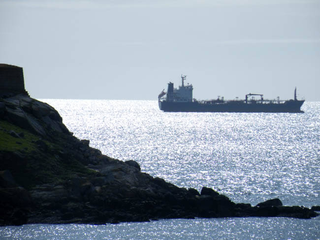
A case of ‘NIMBY-ism’ or justifiable concern?
In this view of a vessel passing Dalkey Island, it shows an approximate direction of the proposed exploratory drill-rig, some 6km offshore of the Dublin Bay coastline. Photo Jehan Ashmore
& Gillian Mills
Upwards of 500 residents, business people and politicians turned out for two information meetings in Dalkey and Dún Laoghaire, Co Dublin last month, and agreed unanimously to call on Phil Hogan, Minister for Enterprise and Local Government, to hold a Public Inquiry into the application by Providence Resources for a foreshore licence to explore the potential of an oil and gas prospect circa 6km off the coast of Dublin in an area known as the Kish Bank Basin.
Providence Resources were invited to attend both meetings but declined, saying in a statement they were willing to discuss the issue with small groups at their Donnybrook Headquarters.
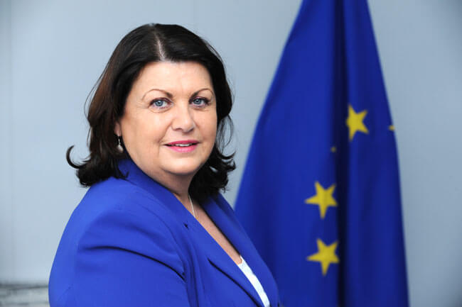
Ireland’s Commissioner says research and innovation policy heads up the political agenda
In November 2009 when European Commission President Mario Barosso offered Ireland’s Máire Geoghegan-Quinn the powerful Research, Innovation and Science portfolio it’s probably true to say that a few eyebrows were raised at home.
And while few doubted Geoghegan-Quinn’s ability to survive in the Brussels hot house, the question was how would someone like her, with no obvious interest or experience in science research, come to grips with one of the Commission’s most wide-ranging, energy-sapping and intellectually-demanding jobs.
Maire Geoghegan-Quinn, EU Commissioner for Research, Innovation & Science
Two years on however, such doubts have long disappeared and Commissioner Geoghegan-Quinn shows no signs of being a fish out of water. On the contrary, she continues to demonstrate a phenomenal energy and an enviable ability to master even the most complex brief, and is seen to be one of the Commission’s best performers.
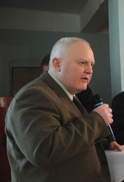
Is Ireland’s renewable energy programme folly, or based on fact?
Pat Swords
The potential of Ireland becoming a leader in marine renewable energy research and production has received much coverage within these pages, most recently on the front-page of the last issue announcing that the world’s largest research centre – the Beaufort Centre - will be operating by 2013.
There are those, however, who challenge these claims as being ‘folly, not based on fact, and even contend some elements are questionable on legal grounds.
Pat Swords, Fellow of the Institute of Chemical Engineers
To debate the issue, Inshore Ireland invited a representative from opposing viewpoints; namely Pat Swords, Fellow of the Institute of Chemcial Engineers and a Chartered Environmentalist, and Peter Coyle, Chairman of the Marine Renewable Energy Association which represents many of those currently involved in the sector.

Seabed mapping data now returning value-added projects to the State
& Gery Flynn
Opening the 2011 annual INFOMAR (Integrated Mapping for the Sustainable Development of Ireland’s Marine Resource) conference, Michael Manley, assistant secretary DCENR and chair of INFOMAR’s Board reminded delegates that its predecessor programme, INSS (to 2005), had delivered a “national asset” that provided Ireland with a data set to underpin economic, environmental, infrastructural, social and policy issues.
“There remains now a crucially important body of work to follow, to map commercially valuable inshore and other waters outside the scope of that achieved by the INSS,” Manley said.

New marine maps show the way for Ireland’s underwater economy
John Joyce, Marine Institute
Exciting new developments in Ireland’s capacity to uncover its past and explore its future economic potential were revealed last month at a seminar on underwater mapping at the Marine Institute in Galway.
Speakers at this annual seminar of the INFOMAR (INtegrated Mapping FOr the Sustainable development of Ireland’s MARine Resource) programme discussed the discovery of new and historic underwater wreck sites; the application of seabed mapping in the selection of sites for generating wave energy; the protection of fish spawning grounds, and the planning of fish farm sites.
https://oceanfocus.ie/wp-content/uploads/2020/05/Ocean_Focus_marine_Publication.png
0
0
Guest Writer
https://oceanfocus.ie/wp-content/uploads/2020/05/Ocean_Focus_marine_Publication.png
Guest Writer2011-11-17 16:26:052019-02-14 08:53:48Jobs bonanza forecast for ocean energy sector – but only with government action