
Restructuring of lobster fishery to avert stock collapse
Proposed changes in managing access to the Irish lobster fishery if accepted by the industry will see the Irish coast divided into eight units. All authorised vessels under or equal to 12m in length will be licensed to fish for lobster; however vessels over 12m will be only be authorised on the basis of established track record.
Managing Access to the Irish Lobster Fishery, which was prepared by BIM in consultation with the Lobster Species Advisory Group, follows on from an analysis of lobster stocks that revealed over-exploitation in many areas around the coast.
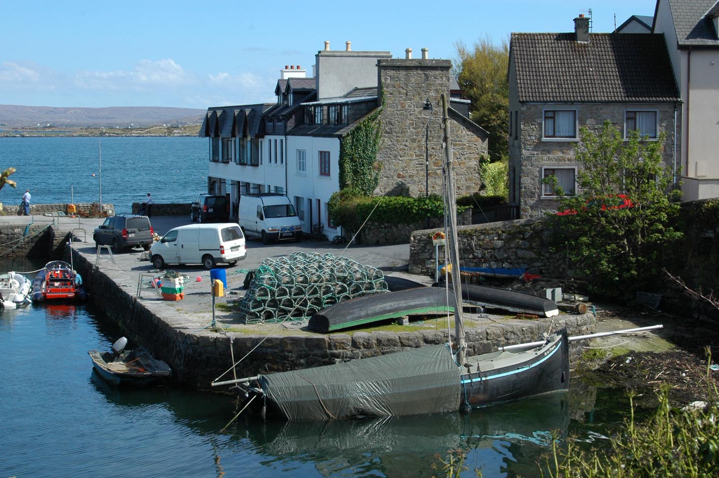
Pic: Lobster fishermen in the Roundstone area will primarily fish out of Management Unit 5b. Photo G Mills
Total capacity of vessels authorised to fish lobster will be stabilised once initial authorisations are issued, and further increases will be conditional upon improvement in catches and as agreed by industry.

Building a bridge between you and the EU
The European Commission Representation in Ireland is part of a network of representative offices throughout the Member States of the European Union. It is the Commission’s voice in Ireland, and aims to communicate EU affairs at national and local level.
Inshore Ireland asked the Dublin Office about its role specifically relating to fisheries, aquaculture and maritime affairs:
The Commission’s role is framed by the Common Fisheries Policy (CFP). It proposes legislation at EC level; manages EC funds earmarked under the CFP, and monitors the application of EC law. In some specific cases, the Commission also adopts detailed technical rules.
Unique design to aid Ireland’s seabed mapping capabilities?
Running before dark skies that were building in the Irish Sea, a silver shimmer appeared on the horizon off Bray Head. It was the RV Keary – a purpose built, aluminium catamaran whose journey had begun 7,000 miles away in a boatyard in Cape Town almost two years ago.
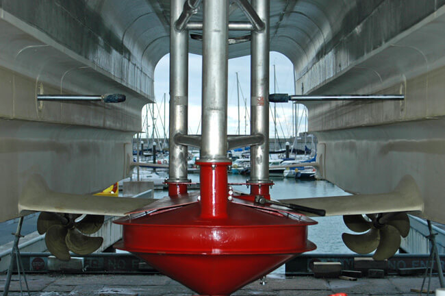
High speed props, hydrofoil stabilising rams and the asymmetric hull combine to create a highly technical craft. Photo Gillian Mills/Inshore Ireland
The vessel is named after the late Ray Keary of the Geological Survey of Ireland who for years had quietly championed the value of Ireland’s marine resource. Finally his message was heard when the GSI received approval from government in 1999 to commence mapping Ireland’s seabed territory, an area that is nine times the size of its landmass.
 https://oceanfocus.ie/wp-content/uploads/2019/08/Ketchikan.jpg
399
600
Gillian Mills
https://oceanfocus.ie/wp-content/uploads/2020/05/Ocean_Focus_marine_Publication.png
Gillian Mills2009-02-15 13:54:282019-08-15 14:47:31Ketchikan: canned salmon centre of the world
https://oceanfocus.ie/wp-content/uploads/2019/08/Ketchikan.jpg
399
600
Gillian Mills
https://oceanfocus.ie/wp-content/uploads/2020/05/Ocean_Focus_marine_Publication.png
Gillian Mills2009-02-15 13:54:282019-08-15 14:47:31Ketchikan: canned salmon centre of the world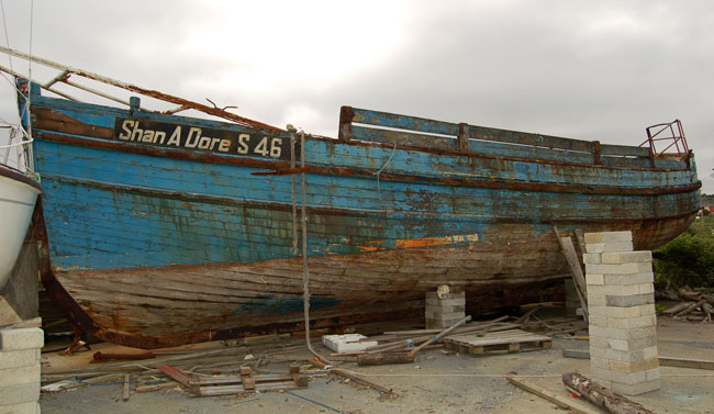
Clare Traditional Boat and Currach Study 2008
Darina Tully
In the summer of 2008, an audit of the traditional boats and currachs of Co Clare was undertaken by the author. A steering group of interested parties was set up under the direction of Congella McGuire, Clare Heritage officer and Tomas Mac Conmara, Heritage Project officer. The project produced an inventory of traditional boats and currachs that established a priority list for their future conservation. The study also examined the local variations in traditional boat and currach building, associated customs, usage and typology.
50ft fishing boat at Kilrush boatyard. Photo Darina Tully
Vessels over 25 years
The audit was confined to boats deemed to be ‘heritage boats’. In keeping with the definition of heritage under The Heritage Act 1995, heritage boats were defined, for the purposes of this study, as vessels over 25 years old.
The project found that Co Clare has three distinctive areas of water-based transport: the dynamic West Coast, the Shannon Estuary and the relatively calm waters of Lough Derg. Thirty classes of boats were identified in use within the county. Currachs and gandelows make up more than half of the 220 heritage boats now on the inventory.
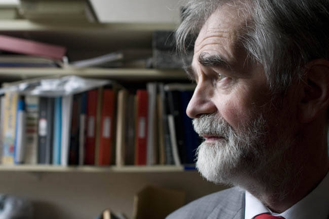
A snapshot of Ireland’s earth science agency
As director of the Geological Survey of Ireland for the last seventeen years, Dr Peadar McArdle has managed to steer the agency on a course that has given the public a wider awareness of the potential economic benefits of the marine environment.
After a primary degree in geology from UCD in the early 70s, McArdle continued with postgraduate research before heading to Africa where he gained invaluable experience as a young geologist with the national survey of Malawi.
On his return to Ireland he spent a short time in the private sector with Silvermines before joining the Geological Survey in 1975 where he was involved in the minerals area.
 https://oceanfocus.ie/wp-content/uploads/2020/05/Ocean_Focus_marine_Publication.png
0
0
Guest Writer
https://oceanfocus.ie/wp-content/uploads/2020/05/Ocean_Focus_marine_Publication.png
Guest Writer2009-01-30 08:32:592019-02-13 17:22:01Long-term lobster storage: fact file
https://oceanfocus.ie/wp-content/uploads/2020/05/Ocean_Focus_marine_Publication.png
0
0
Guest Writer
https://oceanfocus.ie/wp-content/uploads/2020/05/Ocean_Focus_marine_Publication.png
Guest Writer2009-01-01 11:31:002019-02-13 17:17:16‘Star Trek’ technology for coastal surveys
https://oceanfocus.ie/wp-content/uploads/2020/05/Ocean_Focus_marine_Publication.png
0
0
Guest Writer
https://oceanfocus.ie/wp-content/uploads/2020/05/Ocean_Focus_marine_Publication.png
Guest Writer2009-01-30 08:32:592019-02-13 17:22:01Long-term lobster storage: fact file
https://oceanfocus.ie/wp-content/uploads/2020/05/Ocean_Focus_marine_Publication.png
0
0
Guest Writer
https://oceanfocus.ie/wp-content/uploads/2020/05/Ocean_Focus_marine_Publication.png
Guest Writer2009-01-01 11:31:002019-02-13 17:17:16‘Star Trek’ technology for coastal surveysThe gandelows of the Shannon Estuary
Darina Tully
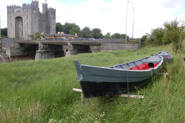
The indigenous wooden boat of the Shannon Estuary is a dory-style boat known locally as a ‘gandelow’. The boats have a flat bottom and are clinker-planked although there is also a yawl type that is carvel built.
The gandalows could have evolved locally, as the boat's shape enables fishermen and farmers to expolot the tidal areas of the estuary. Photo Darina Tully
Just like a dory, there is considerable sheer in the bow. Different styles of gandelow can be found within the Shannon Estuary. Boats found in the Cashen, Clarecastle, Killadysert, Bunratty and Limerick City areas all display regional differences, mainly in the shape of the stern.